CEREGE UMR 7330 CNRS
Type of resources
Available actions
Topics
INSPIRE themes
Keywords
Contact for the resource
Provided by
Years
Formats
Representation types
Update frequencies
status
Scale
-
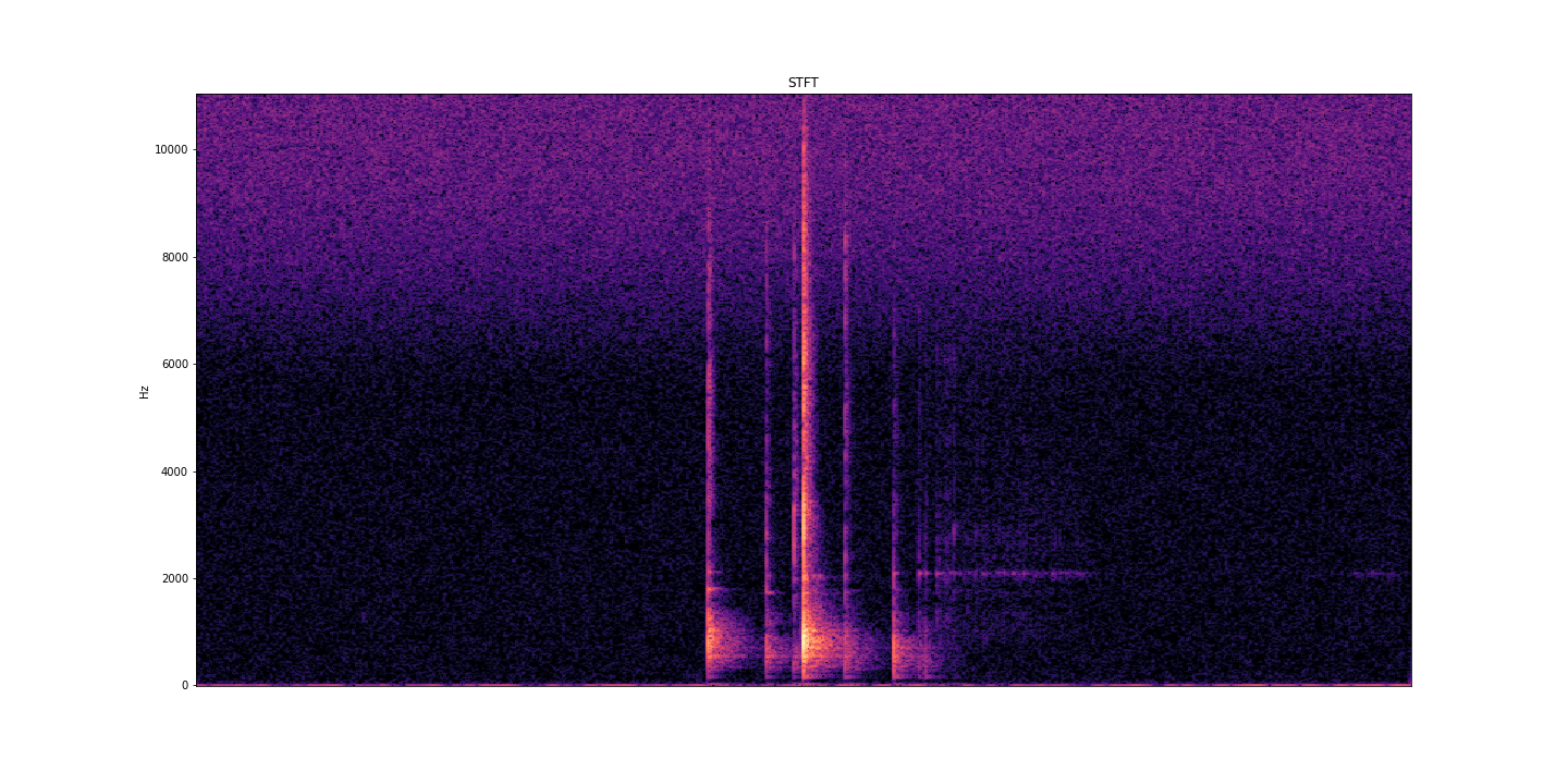
AcoustRivNN proposes to develop a system to estimate the flow and the granulometry of the sediment transport in a river from the acoustic pressure generated by the latter using methods from artificial intelligence. The estimation of the sediment flow carried by water, in rivers or estuaries, is a crucial issue for the management of the latter, allowing to carry out scientific studies, restoration or prevention projects, as well as operational works. Given the lack of effective methods to estimate the flow of sediment, the AcoustRivNN project proposes to provide a "proof of concept" by developing an original system based on deep learning to estimate the flow of coarse sediments from the simple acoustic pressure generated by the latter and measured by hydrophones. The originality of this project lies, in particular, in its interdisciplinary aspect proposing to adapt methods from artificial intelligence particularly effective in many applied fields. This project, which is part of the transversal axis 2: "Observations/information systems/modeling" of the ECCOREV federation, is structured in two phases: - Phase I proposes to build an acoustic database referenced in the laboratory necessary for the training of a neural network. - Phase II aims to develop a neural network model to characterize the acoustics of sediment flow. DOI: https://doi.org/10.34930/dc3225de-ef03-4134-927e-2347d75d8b41 Citation: Gassier, G., Michal, T., & Dussouillez, P. (2022). AcoustRivNN : flow and the granulometry of the sediment transport in a river from acoustic pressure [Data set]. CEREGE UMR 7330 CNRS. https://doi.org/10.34930/DC3225DE-EF03-4134-927E-2347D75D8B41
-
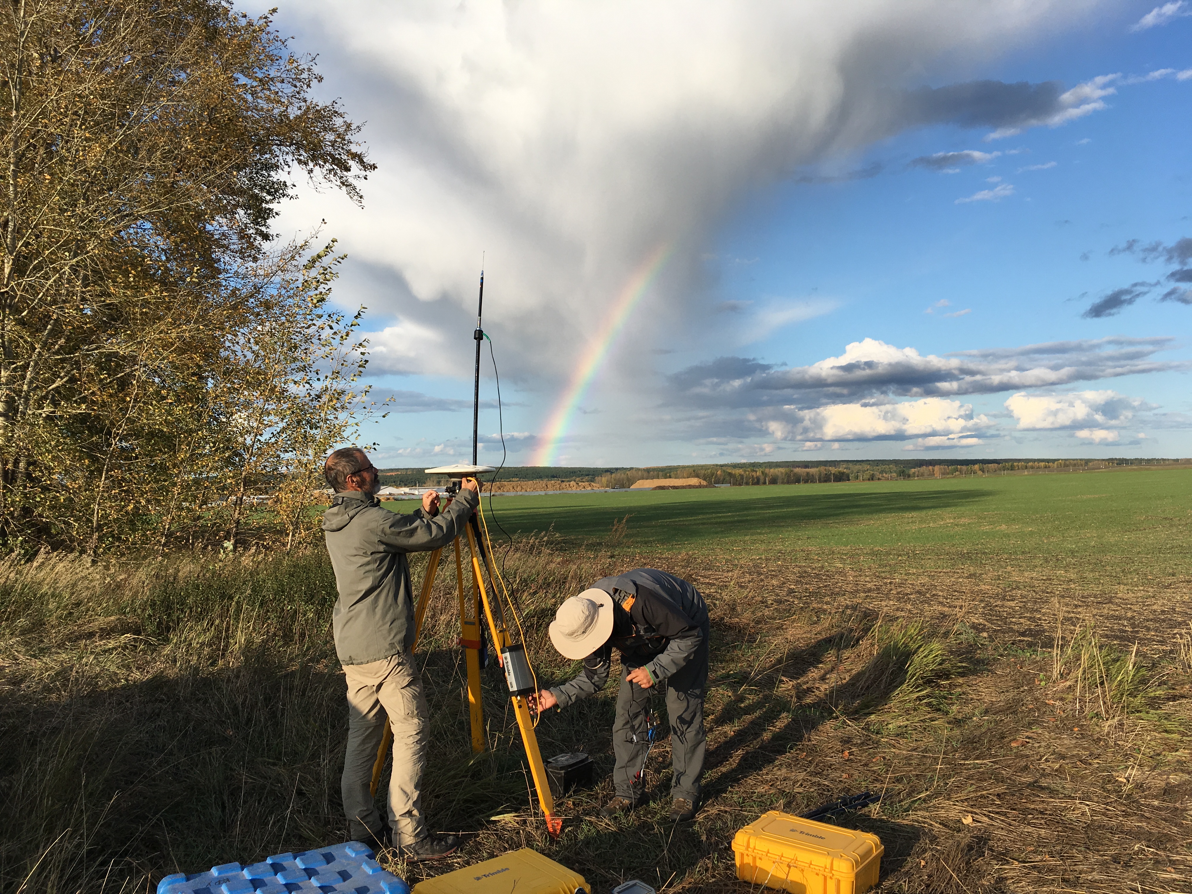
The GeoKarla dataset gathers geophysical and petrophysical data acquired over the Karla impact structure (Tatarstan, Russia). In September 2019, a field campaign on this eroded and buried structure was performed. Magnetic and gravity field observations were done, as well as geological mapping and sampling. Further petrophysical analyses in laboratory were performed on rock samples. All these data reveal - for the first time - a clear but unusual geophysical signature of the Karla impact structure. ==== acknowledgements ====== The associated research project was funded by: Russian Foundation for Basic Research RFBR grant no.18-55-5014 CNRS PRC French program Institutes/Participants: * Aix-Marseille Université, CNRS, IRD, INRAE, Aix-en-Provence, France Quesnel, Y., Rochette, P., Gattacceca, J., Uehara, M. * Institute of Geology and Petroleum Technologies, Kazan Federal University, 4/5 Kremlyovskaya Str., 420008, Kazan, Russia Bezaeva, N.S., Kuzina, D.M., Nasyrtdinov, B.M. * V.I. Vernadsky Institute of Geochemistry and Analytical Chemistry, Russian Academy of Scences, 19 Kosygin str., 119991 Moscow, Russia Bezaeva, N.S. , Badyukov, D.D. * Institute of Physics and Technology, Ural Federal University, 19 Mira Str., 620002 Ekaterinburg, Russia Bezaeva, N.S. Chareev, D.A. * Institute Experimental Mineralogy, Russian Academy of Science, 4 Academician Osipyan Str., 142432 Chernogolovka, Moscow Region, Russia Chareev, D.A. * National University of Science and Technology “MISiS”, 4 Leninsky Prospekt, 119049 Moscow, Russia Chareev, D.A. * Université de Montpellier, CNRS, Géosciences Montpellier, France Champollion, C.
-

Study of the relationship between superficial water from lake and underground water, to constraint recharge mechanisms.
-

Compilation of the post glacial RSL changes along the western mediterranean basin.
-

The dataset gives the variations of several climatic variables on the 0–10,000 year BP period by increment of 100 year. The variables are reconstructed using pollen data and an inverse vegetation model (BIOME4). The variables are expressed in term of anomalies according to their present reconstructions (0–100 years BP). The resolution of 100 years is certainly not reached for all the pollen diagrams used in the reconstruction. It is rather a maximum resolution. In reality, the time-series at that time step are rather smoothed and it should be unrealistic to interpret events with a length inferior to several centuries. Details are given in Guiot, J., Kaniewski, D., 2015. The Mediterranean Basin and Southern Europe in a warmer world: what can we learn from the past ? Frontiers in Earth Science, 3, 'http://dx.doi.org/10.3389/feart.2015.00028'.
-
Study of the relationship between superficial water from lake and underground water, to constraint recharge mechanisms.
-
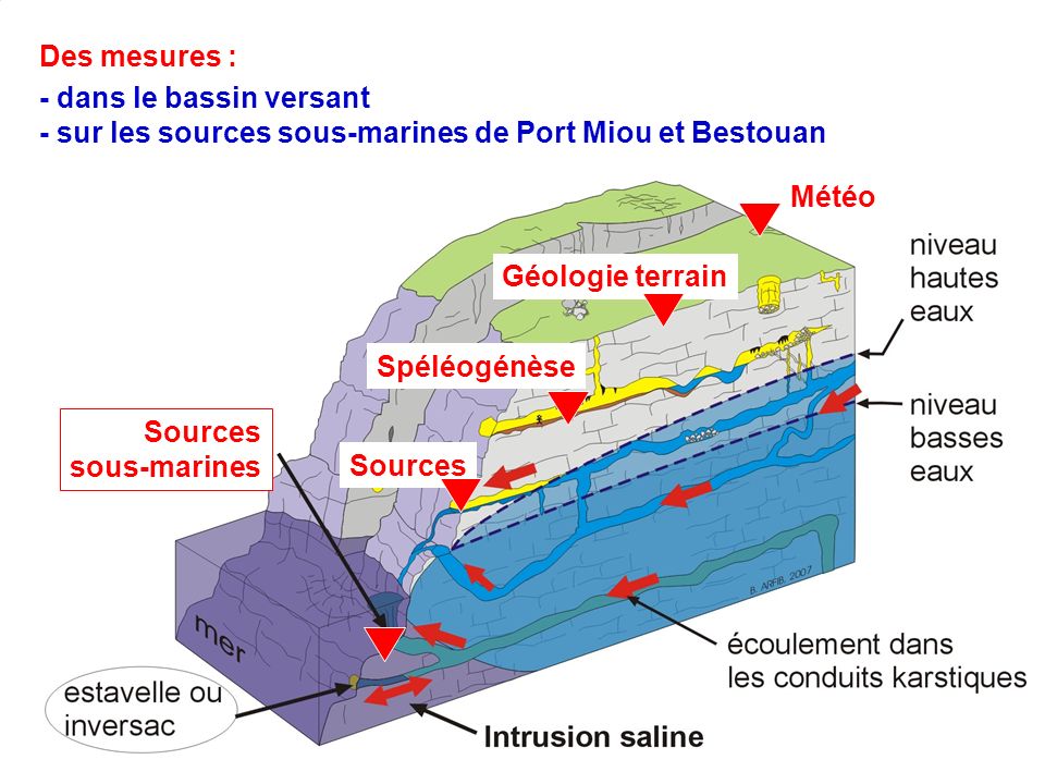
Le site d'observation de Port-Miou est rattaché au Service National d'Observation Karst, dont l'objectif est d'assurer le suivi physico-chimique d'un ensemble de sources et d'hydrosystèmes karstiques sur le territoire français, représentatif du fonctionnement hydrogéologique de ce type d'aquifère. Les sources karstiques côtières de la baie de Cassis ont été identifiées pour le suivi des apports d'eau saumâtre en mer (lien continent-océan) et l'étude du mécanisme d'intrusion saline en aquifère hétérogène et autour de la Méditerranée. Ce sont également des points d'observation de l'impact des changements globaux sur la qualité de l'eau souterraine en zone côtière. Enfin, l'un des objectifs des sites du SNO Karst est d'améliorer les connaissances sur les aquifères carbonatés pour aider à la gestion durable des ressources en eau. La source sous-marine de Port-Miou présente la particularité d'être accessible dans les terres, sur un site constituant un véritable laboratoire souterrain avec un barrage obturant la galerie karstique. Le suivi physico-chimique et biologique est ainsi facilité. PARAMETRES MESURES –DONNEES ACQUISES: - Mesures en continu au pas de temps de 15 minutes : Température eau, Conductivité électrique, Pression, Fluorescence sur 3 gammes de longueurs d'ondes - Mesures ponctuelles : Chimie des ions majeurs, isotopes de l'eau, radon - Mesures en mer dans la calanque de Port-Miou : campagnes de mesure de salinité, radon en surface PROGRAMME DE RATTACHEMENT – Labellisation - Financement - Label SNO Karst (INSU) depuis 2012 - Convention d'accès avec le Conservatoire du Littoral - Projet KarstEAU (2007-2012) : Financement Agence de l'Eau, Conseil Général 13, Région PACA - Projet Région SOURCES (2013-2014) - APIC 2013 (Appel à Projet Interne du CEREGE) - Responsable :. B. ARFIB (arfib@cerege.fr) - Partenaires : Conservatoire du Littoral, Agence de l'Eau, Ville de Cassis, Fondation Camargo, Conseil Général 13, Région PACA - Equipes Pytheas = CEREGE - Responsable :. B. ARFIB (arfib@cerege.fr) - Partenaires : Agence de l'Eau, Ville de Toulon, Conseil Général 83, Région PACA PARTENAIRES - Agence de l'Eau - INSU (Service National d'Observation) - Conservatoire du Littoral (convention d'accès au site du barrage souterrain de Port-Miou pour études scientifiques, renouvelable tous les 5 ans) - Ville de Cassis
-
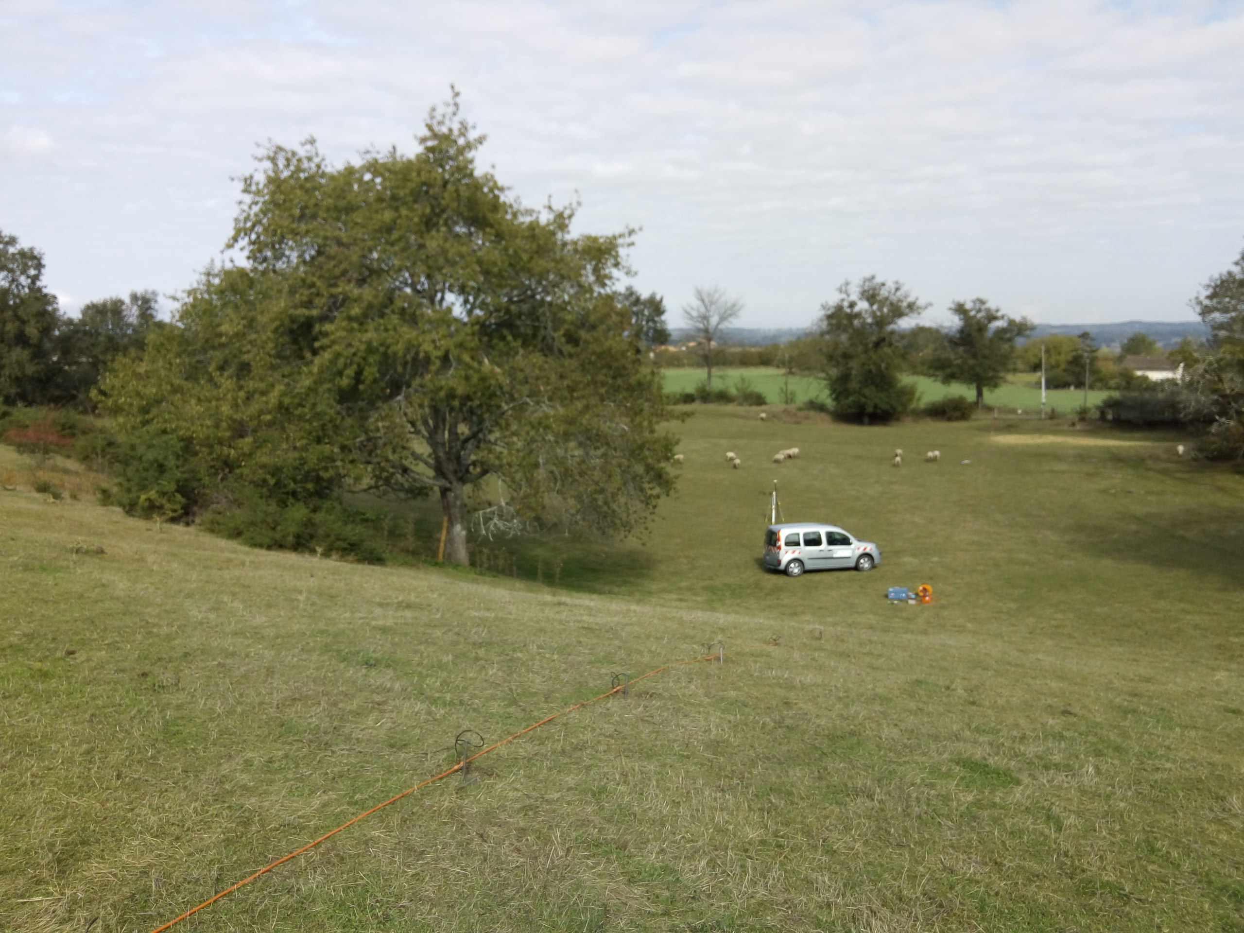
The Rochelec dataset gathers petrophysical and geoelectrical data from the Rochechouart impact structure (France). Since 2017, about 10 geophysical field campaigns were performed on this eroded structure. Among other techniques, geophysical downhole logging, electrical resistivity tomography and controlled-source audiomagnetotelluric data were acquired. In parallel, we measured the electrical resistivity and porosity of some core samples coming from drillings performed in fall 2017 at several sites of the impact structure. These multiscale electric data allows to better characterize the different lithologies outside the drilling sites, and their associated geometry. * Citation of this dataset Quesnel, Y., Sailhac, P., Lofi, J., Lambert, P., Rochette, P., Uehara, M. & Camerlynck, C. (2021). RochElec : Geoelectrical investigations on the Rochechouart impact structure (France) [Data set]. CEREGE UMR 7330 CNRS. https://doi.org/10.34930/BE0549D1-E876-49C5-B07F-BF04D398B25E * Publications linked with the dataset: Quesnel, Y., Sailhac, P., Lofi, J., Lambert, P., Rochette, P., Uehara, M. & Camerlynck, C. (2021). Rochechouart impact structure, France. Geochemistry, Geophysics, Geosystems, 22, e2021GC010036, https://doi.org/10.1029/2021GC010036
-
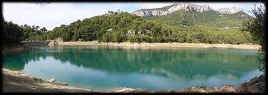
La ville de Toulon est traversée par le cours d'eau "Le Las" qui trouve sa source dans la retenue de Dardennes et au gouffre du Ragas et se jette en mer 8 km plus loin. Le Las constitue une ressource en eau potable, et génère un risque inondation. L'alimentation du Las est principalement assurée par des sources karstiques. Le suivi physico-chimique de toutes les sources karstiques du Las a pour objectif de mieux connaître la ressource en eau exploitable dans l'aire Toulonnaise. Ce suivi est aussi nécessaire pour appréhender l'origine de l'eau dans le Las en crue. Enfin, ces données sont également importante pour faire le lien avec le fonctionnement écologique du cours d'eau. PARAMETRES MESURES –DONNEES ACQUISES: - Mesures en continu au pas de temps de 15 minutes : Température eau, Conductivité électrique, Pression, - Mesures ponctuelles : Chimie des ions majeurs, isotopes de l'eau, débit, fluorescence sur 3 gammes de longueurs d'ondes PROGRAMME DE RATTACHEMENT – Labellisation – Financement - Projet KarstEAU (2007-2012) : Financement Agence de l'Eau, Conseil Général 83, Région PACA - Projet Dardennes (2013-2016) : Financement Agence de l'Eau, Ville de Toulon, Véolia, Cabinet Cénote PARTENAIRES : - Agence de l'Eau - Ville de Toulon - Association SpéléoH2O (Thierry Lamarque) - IFREMER-IRSN
-
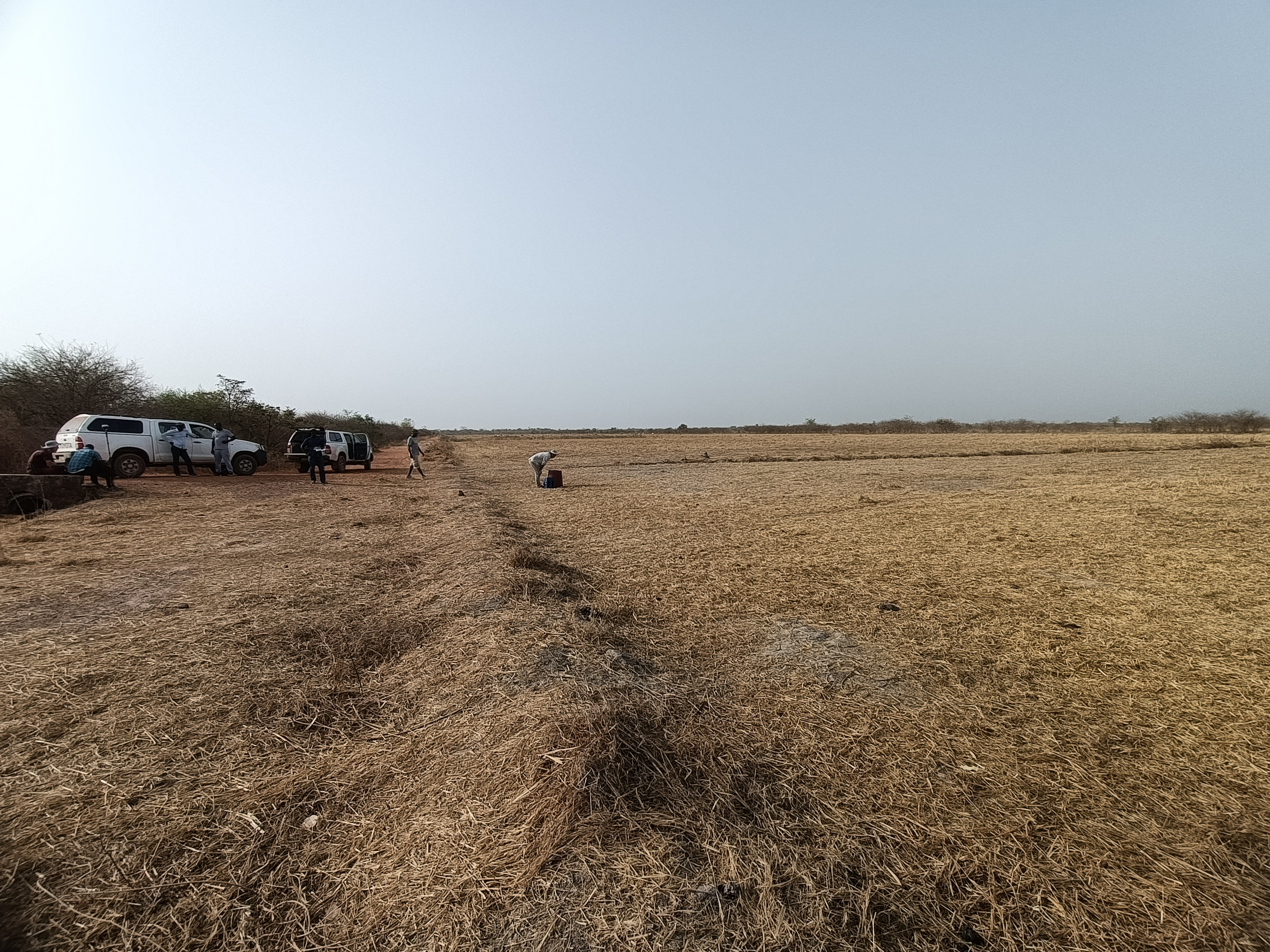
The Velingara dataset gathers geophysical and zircon data acquired in the Velingara circular depression (Senegal). In March 2022, a field campaign was performed in this depression, since it is thought to be an impact structure. Magnetic and gravity field observations were done, as well as sampling. Several zircon grains of sample VEL29A were analysed by LA-ICP-MS, given an age of 550 Ma.
 OSU Pytheas - Data Catalog